
Station -la Maîtaz - le Rey


Track information
Elevation (m)
:
552
Distance (km)
:
8
Daily duration (minutes)
:
270

 Departure/Arrival
 Point of interest
Circuit n° 1
Environments
- Environnements :
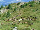
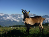
- Mountain location
Download
In short
- Type d'itinéraire :
- Durée :
- 1 demi-journée
- Levels of sporting experience :
- Level bue - easy
- Pedestrian sports :
- Pedestrian sports
- Hiking itinerary
- Ouvertures complementaires :
- Subject to favorable weather
Description
- Informations Pratiques :
- Itinéraire balisé
- Period :
- Autumn
- Summer
- Spring
- Sitra promotion typology :
- Open air
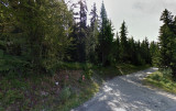
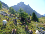
Take the road that climbs behind the tourism office, then first left (route des espagnols).
Pass the tennis courts (on the left below the road), and follow until a crossroad. Take the dust road on the right (follow the sign posts).
Pics
Pics


OT Peisey-Vallandry
Accueil
Phone : +33 4 79 07 94 28
We also suggest...
