- Home >
- Discover >
- Nordic site >
- Nordic site activities >
- Le Cougne
Le Cougne


Track information
Elevation (m)
:
144
Distance (km)
:
6
Daily duration (minutes)
:
150
 Departure/Arrival
 Point of interest
Circuit n° 1
Download
In short
- Type d'itinéraire :
- Durée :
- 1 à 2 heures
- Levels of sporting experience :
- Level green –very easy
- Pedestrian sports :
- Pedestrian sports
- Hiking itinerary
Description
- Period :
- Autumn
- Summer
- Winter
- Spring
- Open year round
- Sitra promotion typology :
- Open air
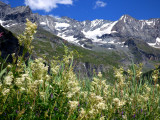
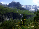
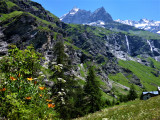
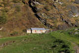
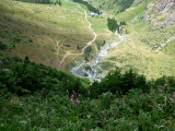
Quiet stroll along the Ponthurin creek, in a great landscape, ideal for a family walk. Glaciers, waterfalls, marmots and bearded vultures.
Pics
Pics