- Home >
- Le bief St Michel
Le bief St Michel


Track information
Elevation (m)
:
355
Distance (km)
:
4
Daily duration (minutes)
:
120
 Departure/Arrival
 Point of interest
Download
In short
- Type d'itinéraire :
- Durée :
- 1 demi-journée
- Levels of sporting experience :
- Level green –very easy
- Pedestrian sports :
- Pedestrian sports
- Hiking itinerary
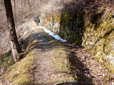
- Natures terrain :
- Stone
- Ground
- Suitable for all terrain strollers
Description
- Informations Pratiques :
- Itinéraire balisé
- Period :
- Autumn
- Summer
- Spring
- Sitra promotion typology :
- Open air
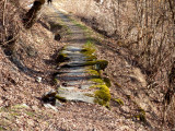
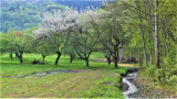
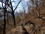
Nice forest stroll crossing several hamlets.
Starting from Landry square following up toward the church.
You might see squirrels, deers, boar... if you're lucky !
You might see squirrels, deers, boar... if you're lucky !
Pics
Pics


We also suggest...
